Snow, Cold Front Headed For Northeast, Including New York, Putting Spring On Hold
A burst of winter weather is returning to the Northeast just as spring conditions had begun to take hold, with a fast-moving system bringing snow and cooler temperatures back to the region.
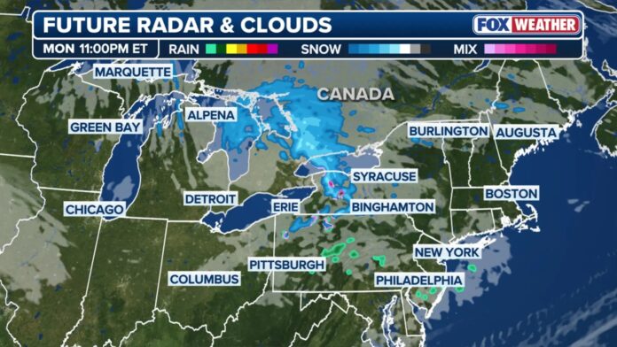
A clipper system is moving quickly across the Northeast, delivering light snowfall to several major cities, while areas of upstate New York had already begun seeing snow early Monday.
Syracuse, New York, reported accumulating snow, and forecasters say locations including Boston and Burlington, Vermont, could receive a light coating through Tuesday.
The late-season system is a reminder that the severe 2025–2026 winter has not fully loosened its grip.
This past winter has been marked by extreme conditions, including repeated heavy storms that blanketed parts of the Northeast with multiple feet of snow, disrupted daily life, and broke longstanding records.
Across the region, powerful blizzards and coast-to-coast storm systems contributed to what many are calling one of the most intense winters in recent memory.
Looking ahead, forecasters expect scattered snow showers and cooler-than-average temperatures to persist from the Great Lakes through New England between Monday and Wednesday.
According to the FOX Forecast Center, the passage of a cold front is ushering in a return of colder air across both the Northeast and parts of the mid-Atlantic.
“While not unusually cold for this time of year, Monday’s temperatures will fall closer to seasonal averages with highs in the 40s and 50s,” they noted.
At the same time, a developing low-pressure system over the Great Lakes is drawing in enough moisture to support light snowfall across the region.
Snow totals are expected to remain modest, generally ranging between 1 and 3 inches, with slightly higher accumulations possible near the Great Lakes and in elevated areas such as the Adirondacks.
Cities expected to see snow include Buffalo; Syracuse, with 1 to 3 inches forecast; Burlington, around 1 inch; Albany; and even light flurries in Boston and New York City.
Meteorologists note that most of these locations typically experience their final measurable snowfall by early to mid-April.
Beyond the snowfall, a broader drop in temperatures is expected to impact a large portion of the region.
After experiencing near-record warmth in recent days, temperatures are forecast to plunge 10 to 20 degrees below average from Monday through Wednesday.
Wednesday is expected to bring the coldest conditions, with wind chills dipping into the 20s across inland areas of the Northeast.
Conditions are expected to moderate by Thursday, with temperatures climbing back toward more typical seasonal levels.